If you are interested, here is a link to the whole documentary on youtube.
If you dont care to watch the whole thing, here is a short summary.
The Mystery of the Megaflood was all about the Channeled Scablands in Lincoln County of Washington state and how they were formed pretty much over night.
When one sees something similar in form to the grand canyon, most would think that it was carved over several million years and in most cases the majority would be right. However in the case of the Channeled Scablands, the majority of the formations were carved out in a matter of hours.
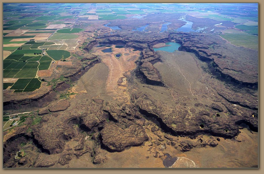
Here is an aerial view of the scablands, just so you can see the extent of the canyons.
It doesnt look much like the grand canyon does it? It doesnt appear to be carved out by a meandering river or any other sort of slow erosion method.
It turns out that this was formed by a massive amount of water rushing through the area. The question that was asked by most was where did the water come from. The answer was not come across very easily, but it was found in the Missoula valley. Evidence here shows that the whole valley was once underwater. This was because a giant glacier blocked off the mouth of the valley and dammed up the river there, creating what essentially became a giant bowl. The valley filled with water over a long period of time before the glacial dam finally gave way, releasing all of the water which rushed over the land towards the pacific ocean. When it passed over the Scablands, it carved out the formations seen today as well as depositing, large granite rocks and creating deep pools in the landscape. How all of this happened is explained in the documentary itself and it is quite fascinating.
Remember how I said that the Scablands were created in hours? That is only partially true. There evidence that shows that there might have been several megafloods that continuously changed the scablands layout, so it was both carved out in hours as well as over millions of years so in a way, everyone is right!


